Existing Solutions:
Sensor Networks:
Currently sensor networks are limited in the size of their implementation. The largest scale system I could
find is the Silvanet Wildfire Sensor manufactured by Dryad Networks GmbH based in Germany.
This sensor uses a Bosch BME688 which measures Air Temperature, Air Moisture, Air Pressure and Air Quality.
However, the BME688 does not measure the levels of gases precisely, it only measures change in gas
resistance and estimates a CO2 level.
The sensor utilizes a solar panel for power, supercapacitors instead of batteries for storage of electricity
to reduce fire risk and LoRaWan to transmit data.
While LoRaWan does offer low power consumption, its performance can be poor in dense environments such as
forests. It also requires additional proprietary hardware to connect to the Internet
A single sensor costs €48, lasts 10-15 years and has a radius of 100m (for detection of a fire within 1
hour), therefore costing approximately €16 euro per hectare (ha) of detection.


Infrared Cameras:
Infrared cameras are becoming increasingly prevalent as a method of detecting wildfires.
They are deployed either as a camera tower at a high point, or on satellites.
Infrared cameras have the benefit of high range, however, they only spot wildfires after the smoke have
risen above the forest’s canopy. This means that there could be a few hours between a fire starting, and the
fire producing enough smoke to be detected.
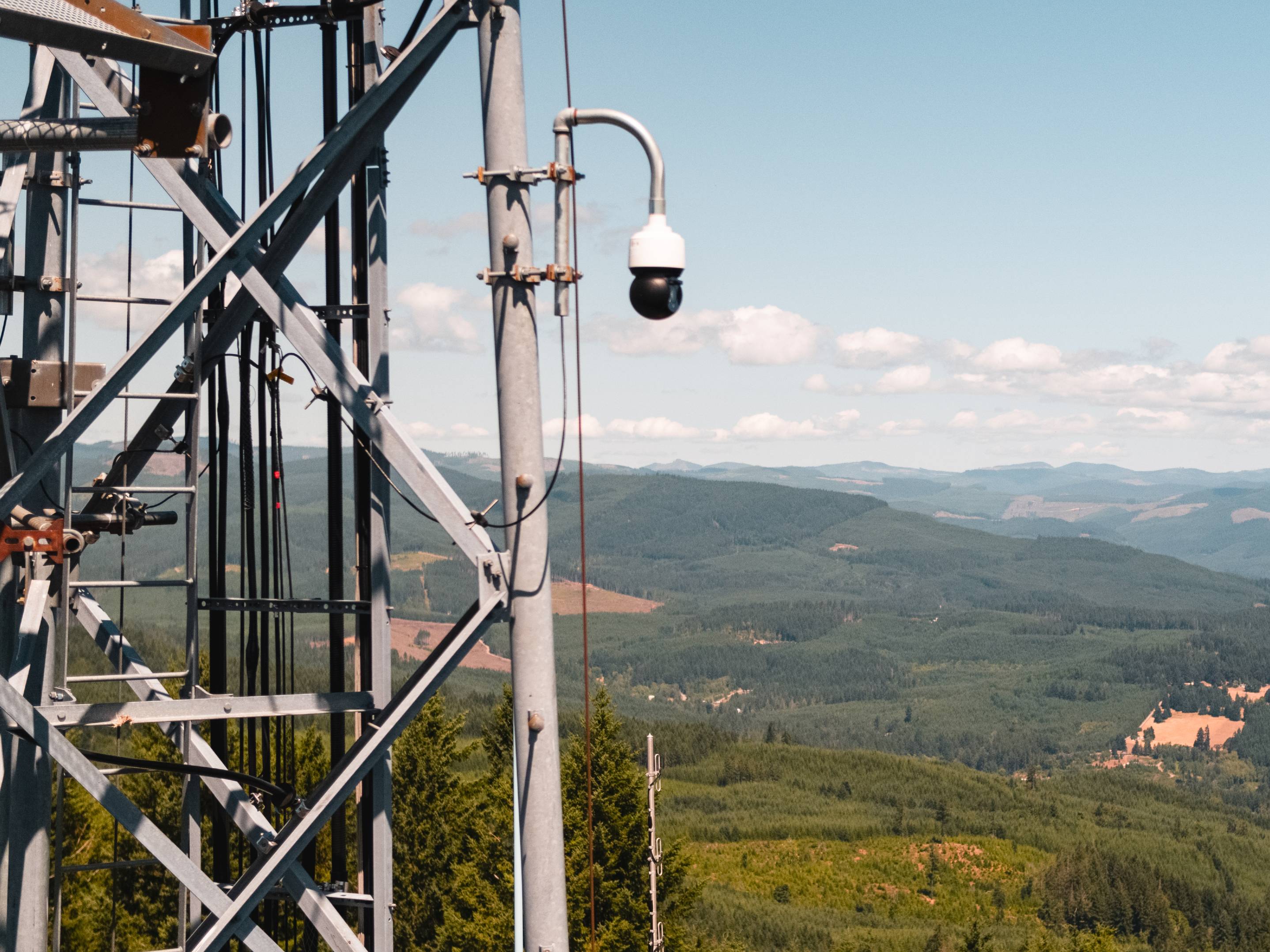
One example of land based infrared detection is Pano AI, a California based company with cameras deployed
across 10 US states,
5 Australian states and British Columbia, Canada. Since 2020, they have detected over 100,000 fires with
their cameras, and according to Pano AI,
their detection has helped lower response time by 20-30 minutes in some cases.
The company has received 89 Million USD in venture capital and was named in the top 100 most influential
companies of 2025 by Time magazine.
Currently satellites are used as a method to monitor fires once they have started and to track the fire’s
border. This is because the current systems: MODIS and VIIRS have resolutions of 1km and 375m respectively.
They also have a low update frequency of around 6 times a day, and slow processing time; with data taking
2-3 hours to be processed before being available to fire agencies.
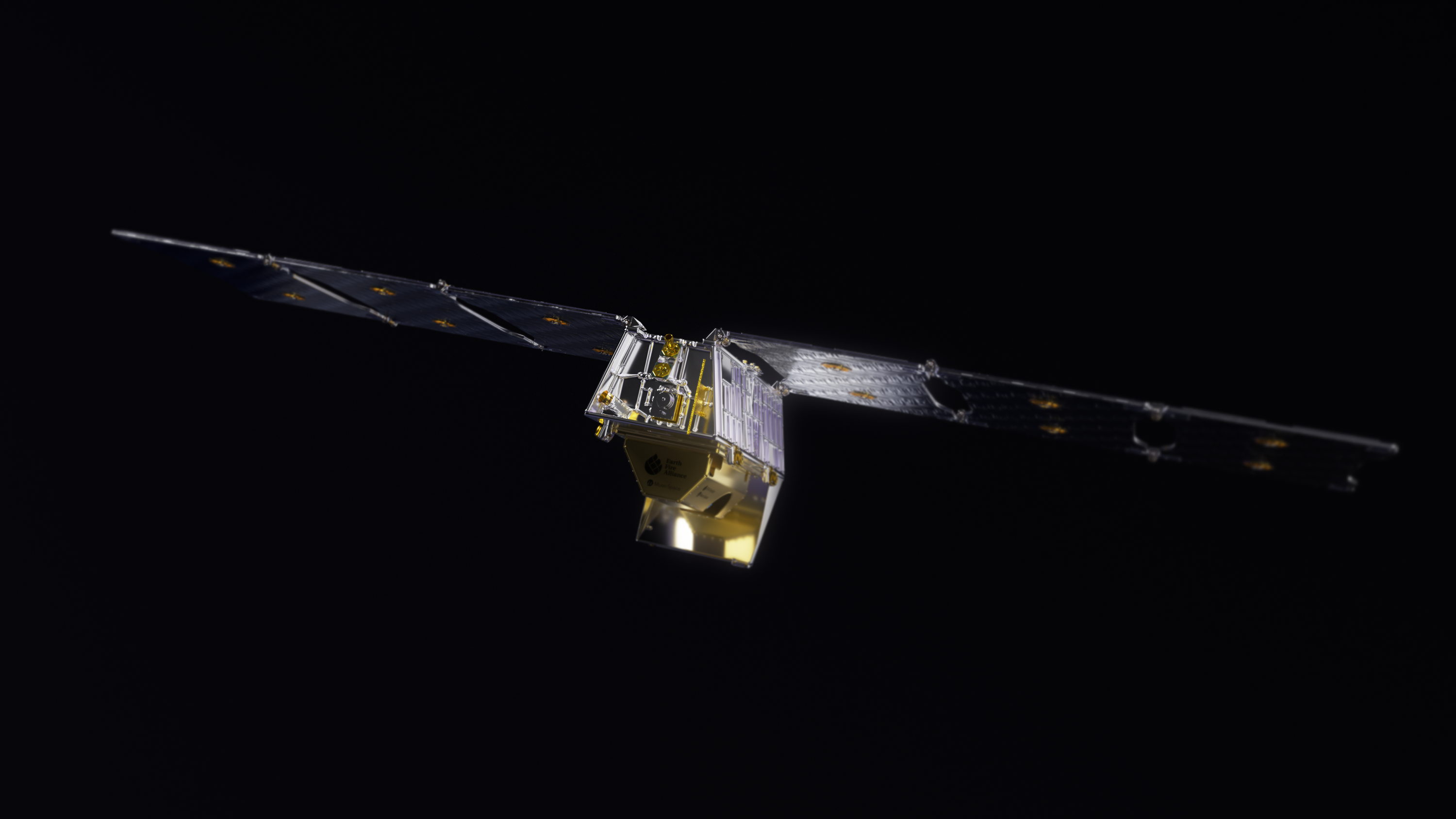
However, in 2025 a non-profit called Earth Fire Alliance in partnership with Google launched FireSat, a new
fire sensing satellite cluster which was named as one of Time magazine’s best inventions of 2025.
The Firesat satellite cluster can detect fires at a resolution of 5x5 metres and updates every 20 minutes.
This system has been successful so far, with 9 agencies across 3 continents using its data.
Earth Fire Alliance plans to build a constellation of 50 satellites by 2030.
The satellites' high resolution and fast updates have the potential to vastly improve the contribution of
satellites in fighting wildfires.
Watchtowers:
Watchtowers have historically been used for detection; however, they are being replaced by other systems.
In the US for example, at one point there were 8000 manned fire lookouts across the country
[3],
now it is estimated that there are only 300 manned lookouts remaining.
[4]
Drones:
Drones have also recently been introduced as a method to prevent and control wildfires.
Several manufacturers offer drones used for prescribed burns, monitoring fires and extinguishing fires.
For example, DJI, a leading drone manufacturer currently sells drones for detecting wildfires.
An example of a DJI firefighting drone (via. dji.com):

Drone Amplified is a company which sells the IGNIS II, a drone used for Prescribed burns.
Prescribed burns were previously done either by firefighters on the ground, which can be a risk to
firefighters,
or aerially, which involved dropping incendiary bombs via. plane or helicopter.
Drones can make aerial burns without need to risk firefighters' lives, or expensive aircrafts.
According to Drone Amplified, their drone costs 15,000 USD, while a helicopter can cost between 5-10,000 USD
a day.