Plan and Design
Stakeholders and their needs
Fire departments
Fire departments need to know what areas are at risk of wildfire, and when a wildfire is currently happening. This information needs to be delivered quickly and precisely for effective emergency response.
Landowners
Landowners also need to know if their land is at risk of fire, how to prevent fires and to be notified when a fire starts, to clear people, livestock or assets from the area. Knowledge of the risk level is also useful for the insurance of land against potential damage from wildfires.
General Public
The public needs to be aware of wildfire risk to stay away from high-risk areas and to not do risky actions such as smoking, barbequing or starting campfires which might start a wildfire.
Government Bodies
Government bodies should also be aware of wildfire risk, effects and trends.
This can help them plan effectively and to make policy decisions.
End users and their needs
Firefighters
Firefighters need to be able to view real time alerts and fire risk data.
Forestry managers
Forestry managers need to be able to view alerts and fire risk data on their land.
This access can help plan preventative measures.
Landowners
Land owners need to be able to check the fire risk data for their land and receive alerts of fires.
System requirements
To satisfy these stakeholder requirements, the system will:
- Constantly monitor weather conditions using sensors.
- Calculate fire risk using weather data and other data.
- Make weather and fire risk data available to stakeholders and end users.
- Be remotely deployable for long periods of time in potentially hard to reach areas.
- Quickly alert stakeholders when a wildfire has started.
Model design
To satisfy the requirement of a fire risk model, the system will use the Fire Weather Index (FWI) model.
I chose to use the FWI model due to its widespread usage internationally, and its usage in Ireland, which allows for comparisons to be made.
The FWI model takes temperature, relative humidity, wind speed, rainfall and day length into account.
FWI is a rules-based model which uses mathematical formulae to calculate fire risk.
System architecture
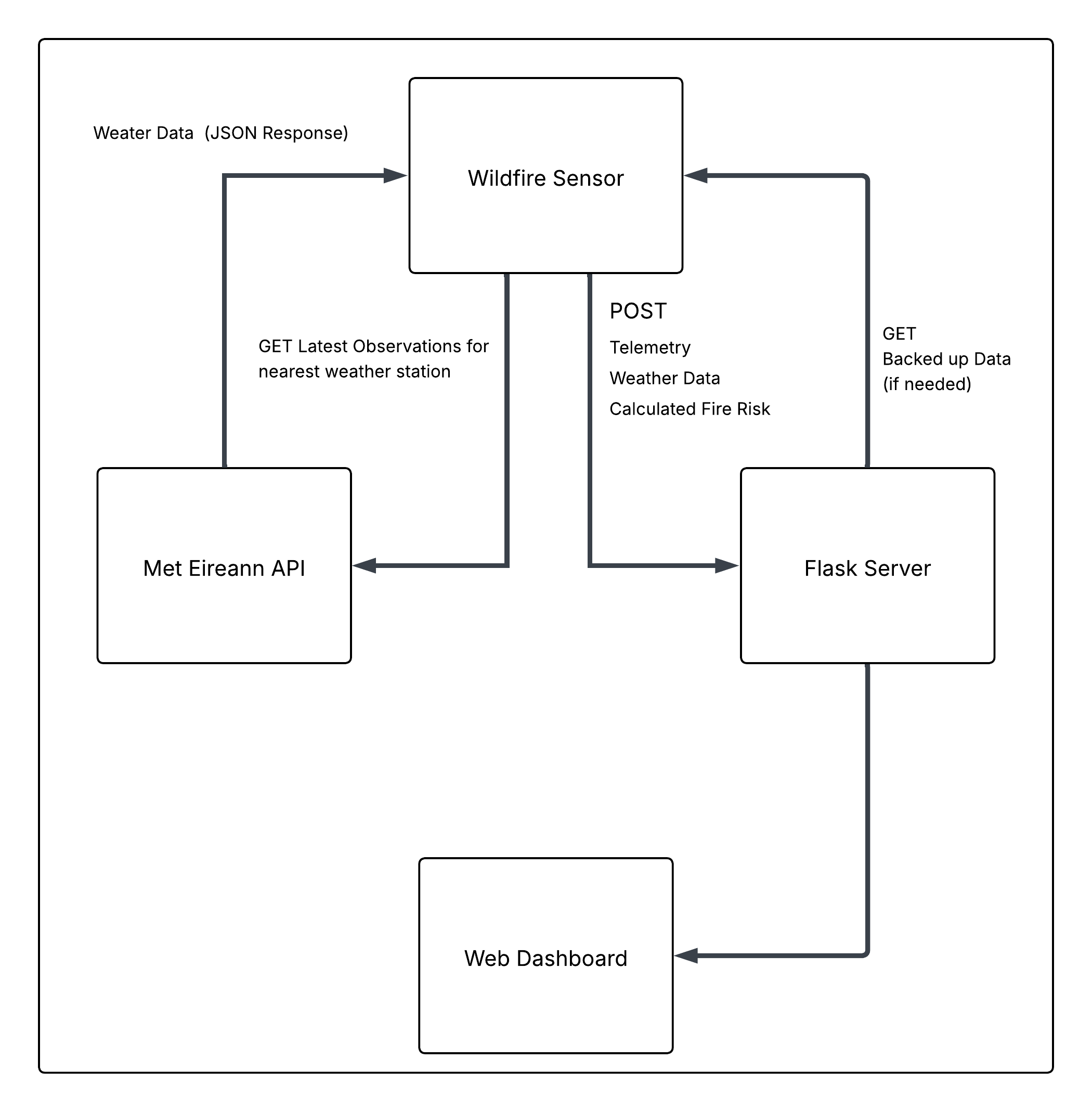
To make the data accessible to end users, the system will follow the following architecture:
- The system will collect sensor data
- The system will collect wind speed and rainfall data from Met Eireann
- The system will use the data to calculate fire risk
- The system will upload this fire risk data to a server
- The server will serve the fire risk data to the end user
The architecture is summarised in the flowchart below:
Hardware Design
To fulfil all the above system requirements, I have selected the following parts.
I have chosen to use development boards for this project, however, the design can be converted to a PCB design using the underlying chips.
-
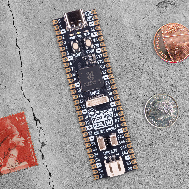
The system will be built around the Pimoroni Pico LiPo 2 XL W microcontroller.
The board is built around the RP2350 chip and has many useful features such as high connectivity, battery management and a good amount of memory. -
The system will use several sensors to input data into the FWI model.
-
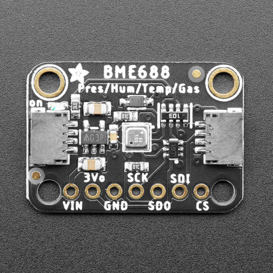
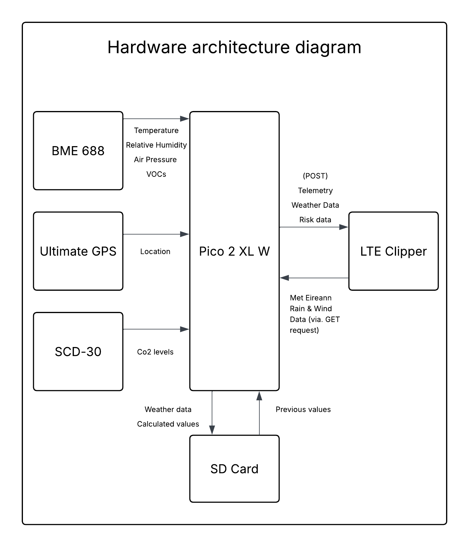
The system will include a Bosch BME688 to measure air temperature, air humidity, air pressure and the concentration of volatile organic compounds.
This sensor is used by Dryad Networks' Wildfire sensors, and the specification document lists wildfire detection as a recommended application.[6] -
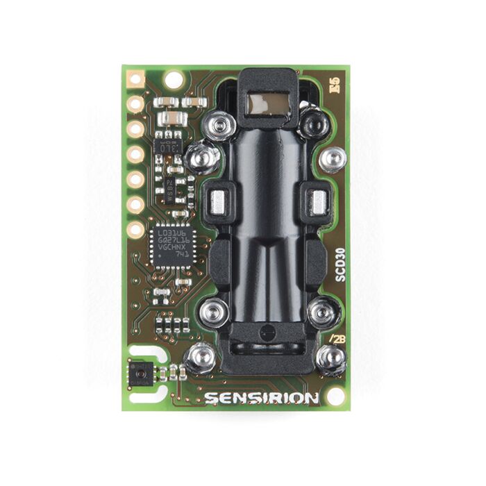
The system will use a Sensirion SCD-30 to detect the level of carbon dioxide in the air.
This sensor is better than most other carbon sensors as it uses NDIR technology to measure only carbon dioxide levels.
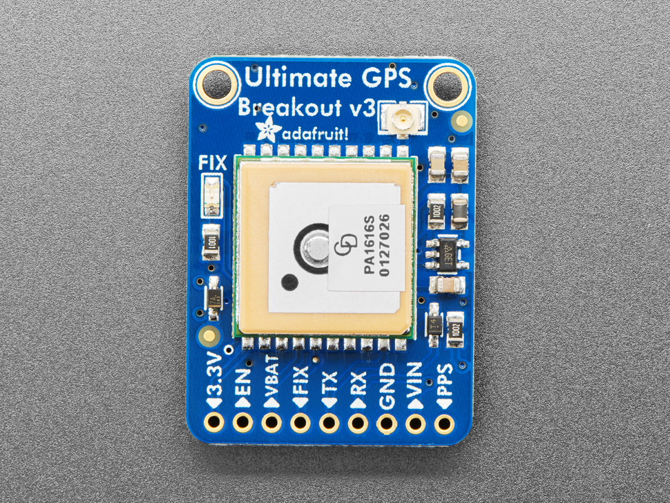
Other sensors typically measure VOC levels and calculate a “eCo2” value, which is only an estimate based on the VOC data. - The system will use a “Ultimate GPS Breakout” from Adafruit, to read GPS data which will be used to get harder to record data like rain and wind data from the nearest Met Eireann station which is used in fire risk calculations.
-
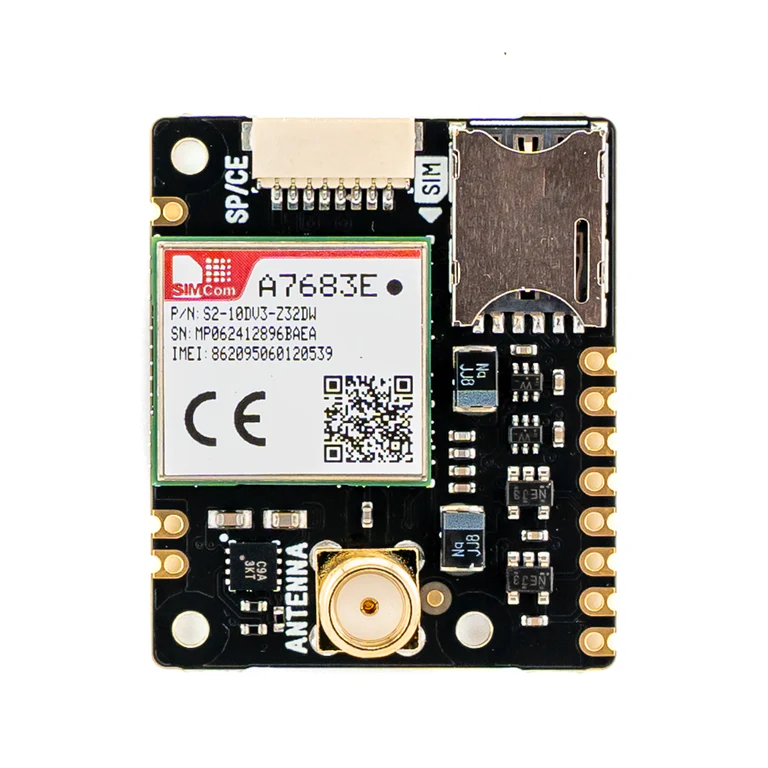
The system will use a Pimoroni LTE Clipper to connect to the Met Eireann API and the server.
I considered LoRa for communication as the Dryad networks sensor uses it, however, LoRa requires additional hardware to connect to the Internet, so LTE was chosen as it needs no extra infrastructure. - The system will include a Lithium-Ion battery to power the system over long periods of time.
- The system will use the Adafruit Micro SD Card breakout to store data locally.
-
The system will include a Bosch BME688 to measure air temperature, air humidity, air pressure and the concentration of volatile organic compounds.
The hardware architecture is summarised in the flowchart below:
Bill of materials
| Component | Model | Manufacturer | Interface | Unit Cost | Purpose |
|---|---|---|---|---|---|
| Microcontroller | Pico LiPo 2 XL W | Pimoroni | SPI, I2C, UART, PWM, ADC | £21 | Main board |
| Environmental Sensor | BME 688 | Adafruit | SPI | £19.50 | Measures temperature, humidity, pressure and gas levels |
| CO2 Sensor | SCD30 | Sensirion | I2C, PWM | €31 | CO2 Sensor |
| LTE Modem | LTE Clipper | Pimoroni | UART | £24 | Provides cellular connection |
| GPS Module | Ultimate GPS | Adafruit | UART | £30 | Tracks the systems location |
| SD Card Reader | Micro SD Card Breakout Board | Adafruit | SPI, SDIO | £3.60 | Stores sensor data locally |